Canyon to Alpine Lillooet Hiking Guide

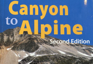
The Lillooet Hiking Guide Second Edition covers 32 day hikes, ranging from arid interior drylands of the Fraser Canyon to the high alpines. Created by the Lillooet Naturalist Society, the book contains trail and access information, route maps and topographical information, colour photos showcasing each hike, and natural history of the land.

Find it at the Lillooet Visitor Centre or email LillooetNS@gmail.com

Continue ReadingCanyon to Alpine Lillooet Hiking Guide

Golden Miles of History

  •   Parking: N50° 40’ 97.9’’ W121° 55’ 89.1’
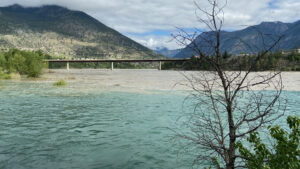
    Park at Bridge of the 23 Camels.
  •   Distance: 4.5 km (2.8 miles)
  •   Time: 1 to 1.5 hours one-way
  •   Difficulty: Easy to moderate walk

This walk highlights the many sights the Lilllooet Historical Society recommends you enjoy in a town whose post-European contact history dates back to the Cariboo Gold Rush. Pick up a “Golden Mile” brochure at the Lillooet Museum and Visitor Info Centre.

Continue ReadingGolden Miles of History

Bridge of the 23 Camels

Following the discovery of gold in the Cariboo in 1858 and the completion of the first wagon road to Lillooet, horses, mules and oxen were used to haul heavy loads to the gold fields. An entrepreneur determined that camels would be ideal pack animals, so 23 two humped Bactrian camels were imported from Asia to BC. But this solution became an issue when the high-strung beasts ate miners clothing, kicked at anyone who came close, frightened other animals with their pungent odor, and cut their soft feet on the rocky mountainous roads. The camels were abandoned and left to roam in the wild. Some were killed for food, some died in winter storms, while others were kept as curiosities. The lone surviving Bactrian camel, “The Lady” as she was called, died around 1896 on a farm in Grande Prairie, BC (now known as Westwold).

When the bridge opened in 1981, the name was selected through a contest. Local resident, Renee Chipman submitted the winning name: “Bridge of the 23 Camels” in honour of the camels.

Continue ReadingBridge of the 23 Camels

Chinese Rock Piles

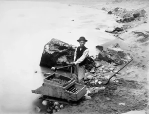
On both sides of the Fraser River at Lillooet one can find “Chinese Rocks” – a reminder of the search for gold by Chinese people before the turn of the century. Washing the sand and gravel for the elusive yellow metal, the Chinese neatly piled the washed rocks, in some places more than 12 feet high, in long rows. For examples, look close to the Hangmen’s Tree, downstream from the Old Suspension Bridge, and on the east side of the Fraser.

Continue ReadingChinese Rock Piles

The Mile “0” Cairn

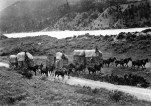
The Mile ‘0’ Cairn was erected in 1939, marking Mile ‘0’ of the old Cariboo Road. From this point in the early stage coach days, all road houses and stopping places from here to Barkerville were known by their mileage from Lillooet – 70 Mile, 100 Mile, and so on. In 1858, Governor James Douglas ordered the construction of a wagon road from Fort Douglas on Harrison Lake to Lillooet. The Royal Engineers supervised the construction while miners with picks and shovels contracted to build the road for the sum of five English pounds each, which they received upon arrival, by land and portage, at Lillooet. 16,000 gold seekers outfitted here in the next four years, until 1863, when the Fraser Canyon route from Yale finally reached Lytton providing an alternate route.

Continue ReadingThe Mile “0” Cairn

The Goldrush

Written by Jane Carrico

“There are all kinds of people on earth that you will meet someday… They will be looking for a certain stone… They will be people who do not get tired but who will keep pushing forward, going, going all the time… They will travel everywhere looking for this stone which our great-grandfather put on the earth in many places.”

Sweet Medicine, Cheyenne Prophet

In 1846, Hudson’s Bay Chief Factor James Douglas sent Alexander C. Anderson to find an all-British route for fur brigades from New Caledonia to the Pacific coast. Anderson explored the series of rivers, lakes and First Nations trails between Harrison Lake and Lillooet but concluded that a short season of unloading & portaging goods made the route as impractical as the Fraser River.

Ten years later, Douglas began supplying First Nations with hand tools to collect placer gold for trade in the Fraser River watershed while American miners trickled in from Oregon Territory. Douglas sent a shipment of gold to the San Francisco mint in 1857, word got out and the stampede was on.

By 1858, there were 30,000 or more miners along the Fraser River and they faced a winter without re-supply.

Douglas contracted Otis Parsons to build a pack trail along the route Anderson explored with labour supplied by the miners themselves. Two years later, the Royal Engineers upgraded the trail into a wagon road and three new steamboats were built to operate on the lakes between Harrison Lake and Lillooet.

Lillooet became an important mining centre & transportation hub with a cable ferry across the Fraser operated by Parsons.

Continue ReadingThe Goldrush

The Chinese in Lillooet

Written by Jane Carrico

The Chinese became part of the recorded history of British Columbia during the earliest days of the sea otter trade when they helped independent merchant John Meares build the first trading post on Vancouver Island in 1788. With the market for the valuable pelts in China, British Columbia was part of the Pacific Rim long before it became part of Canada.

Thousands of Chinese nationals flooded into California when gold was discovered there in 1848 but when stringent laws were passed against them many of them headed north to the new Colony of British Columbia where their rights were protected by British colonial law.

As well as being miners, they built roads & wooden flumes, grew vegetables and opened shops, restaurants & laundries. Many were also employed as cooks and housekeepers including by the prominent Phair family here in Lillooet.

Continue ReadingThe Chinese in Lillooet