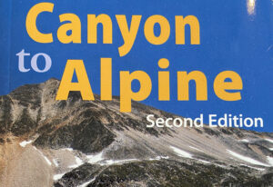
Canyon to Alpine Lillooet Hiking Guide

The Lillooet Hiking Guide Second Edition covers 32 day hikes, ranging from arid interior drylands of the Fraser Canyon to the high alpines. Created by the Lillooet Naturalist Society, the book contains trail and access information, route maps and topographical information, colour photos showcasing each hike, and natural history of the land.

Find it at the Lillooet Visitor Centre or email LillooetNS@gmail.com
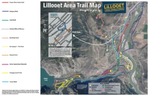
Continue ReadingCanyon to Alpine Lillooet Hiking Guide

Seton Viewpoint

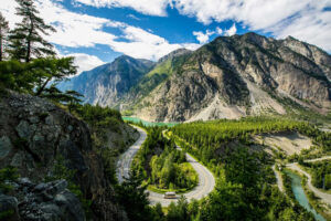
This viewpoint provides a spectacular view of the emerald-green waters of Seton Lake Reservoir and the surrounding Chilcotin mountains.

Near the viewpoint you may also find evidence of kekulis, underground winter homes built by the interior Salish-speaking St’at’imc (STAH-tleum) people. A small self-guided interpretive trail is located at the viewpoint, providing information about the history of the Lillooet area and some of its modern-day features.

Continue ReadingSeton Viewpoint

Naxwit Park

  •   Parking: N50° 40’ 25.1’’ W121° 58’ 11.9’’
    Park in beautiful, paved wayside park.
  •   Distance: 0.35 km (0.2 miles)
  •   Time: 10 minutes
  •   Difficulty: Easy

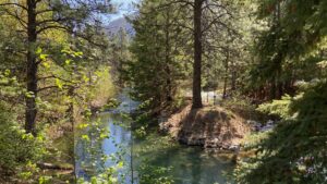
A short, easy walk along fast-moving Seton River offers the chance to see mountain goats on the cliffs above and other wildlife. Trails follow spawning channels full of salmon in season. Interpretive signage reveals local ecology and First Nations history.

Continue ReadingNaxwit Park

Jade Walk

  •   Parking: N50° 42’ 21.7’’ W121° 55’ 55.6’’
    Park at Old Mill Plaza.
  •   Distance: 8.7km (5.4 mi)
  •   Time: 2.4 km from mall to cemetery (30-45 minutes), 5.3 km for complete route (1 to 1.5 hours)
  •   Difficulty: Easy to moderate

This trail commemorates Lillooet’s history as the site of the first jade mine in BC. Stroll down Lillooet’s Main Street and enjoy over 30 unique pieces of jade, some weighing many tons. Pick up a brochure at KC Health & Gifts.

Continue ReadingJade Walk

Fraser River Lions Trail

  •   Parking: 50°40’54.53”N 121°55’49.37”W
    Park in Cayoosh Campground close to the Bridge of the 23 Camels.
  •   Distance: 2.4 km (1.5 miles)
  •   Time: 45 min. one-way
  •   Difficulty: Easy to moderate

Built by the Lillooet Lions Club in the 1990s, the Lions Trail is a staple for local hikers, traversing the bank of the Fraser River through diverse habitat affording breathtaking views of the mighty river

Continue ReadingFraser River Lions Trail