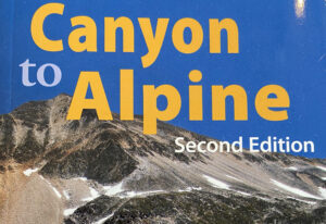
Canyon to Alpine Lillooet Hiking Guide

The Lillooet Hiking Guide Second Edition covers 32 day hikes, ranging from arid interior drylands of the Fraser Canyon to the high alpines. Created by the Lillooet Naturalist Society, the book contains trail and access information, route maps and topographical information, colour photos showcasing each hike, and natural history of the land.

Find it at the Lillooet Visitor Centre or email LillooetNS@gmail.com
Continue ReadingCanyon to Alpine Lillooet Hiking Guide
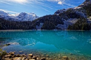
Read more about the article Joffre Lakes Provincial Park
Photo by Carsten Ruthemann

Joffre Lakes Provincial Park

Photo by Carsten Ruthemann

Joffre Lakes Provincial Park has excellent hiking, camping, mountaineering, wildlife viewing, and fishing opportunities. The area is known for the magnificent jagged peaks, icefields, cold rushing streams, and turquoise blue lakes. Glacial peaks are visible from an easily accessible viewpoint 500 metres from the parking lot. Heading towards middle and upper Joffre Lakes, the trail becomes more challenging.

BC Parks requires that park users reserve a day-use pass during the summer and winter periods at select parks to help manage visitation levels at popular day use areas. Reservations can be made online only. At Joffre there is no cell-service to make reservations, so please ensure you reserve a spot prior leaving Pemberton or Lillooet.

Continue ReadingJoffre Lakes Provincial Park

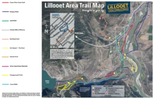
Canal Walk

  •   Parking: N50° 40’ 14.1’’ W121° 58’ 40.6’’
    Park on immediate south side of Canal Bridge on Highway 99.
  •   Distance: 3.2 kms (2 mi.) one-way
  •   Time: 40 minutes
  •   Difficulty: Easy

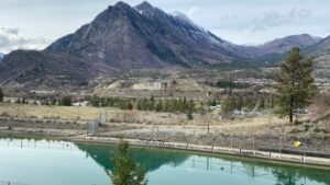
On this level roadway along the south side of the BC Hydro canal which connects Seton Lake with the powerhouse on the Fraser, you walk in the shadow of the majestic towering cliffs at the base Mt. Brew. Watch for waterfowl on the canal.

Continue ReadingCanal Walk

Campground Trails

  •   Parking: N50° 40’ 06.2’’ W121° 58’ 67.3’’
    Park at BC Hydro Campground entrance.
  •   Distance: 3.3 kms (2 mi.)
  •   Time: 60 minutes
  •   Difficulty: Easy to moderate

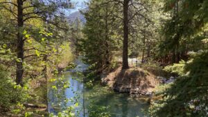
Two pretty loop walks connected by a steep hill. The loops go through forest, along Cayoosh Creek and offer awesome mountain views. Across Highway 99 from the upper bench you can access the incredible Seton Lake lookout.

Continue ReadingCampground Trails

Seton Viewpoint

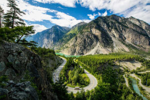
This viewpoint provides a spectacular view of the emerald-green waters of Seton Lake Reservoir and the surrounding Chilcotin mountains.

Near the viewpoint you may also find evidence of kekulis, underground winter homes built by the interior Salish-speaking St’at’imc (STAH-tleum) people. A small self-guided interpretive trail is located at the viewpoint, providing information about the history of the Lillooet area and some of its modern-day features.

Continue ReadingSeton Viewpoint

Naxwit Park

  •   Parking: N50° 40’ 25.1’’ W121° 58’ 11.9’’
    Park in beautiful, paved wayside park.
  •   Distance: 0.35 km (0.2 miles)
  •   Time: 10 minutes
  •   Difficulty: Easy

A short, easy walk along fast-moving Seton River offers the chance to see mountain goats on the cliffs above and other wildlife. Trails follow spawning channels full of salmon in season. Interpretive signage reveals local ecology and First Nations history.

Continue ReadingNaxwit Park

Sát’atqwa7 – The River

  •   Parking: N50° 40’ 51.2’’ W121° 55’ 49.7’’
    Park in parking area just off Powerhouse Road.
  •   Distance: 190 m to 2 km
  •   Time: 30 min. to 1 hour.
  •   Difficulty: Easy (rocky shoreline)

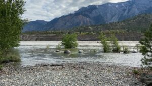
A chance to get up close to the mighty Fraser River. Enjoy a walk through an active ecological restoration site that showcases our beautiful grasslands and Black Cottonwood ecosystem at the confluence of the Seton and Fraser Rivers.

Continue ReadingSát’atqwa7 – The River

Red Rock Trail / Lillooet Grind

  •   Parking: N50° 41’ 52.9’’ W121° 56’ 65.9’’
    Park at the District Public Works Yard at the corner of Columbia Street and 7th Avenue. From there, you can walk to the Red Rock trailhead.
  •   Distance: 3.4 km (2 mi.)
  •   Time: 2 to 3-hour hike
  •   Difficulty: Moderate to difficult, 500 metres elevation gain

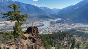
This popular route takes hikers to the famous Red Rock outcropping 500 metres above town, offering an astounding panorama of the Fraser River valley. Local flora and fauna abound. Take water with you.

Continue ReadingRed Rock Trail / Lillooet Grind

Golden Miles of History

  •   Parking: N50° 40’ 97.9’’ W121° 55’ 89.1’
    Park at Bridge of the 23 Camels.
  •   Distance: 4.5 km (2.8 miles)
  •   Time: 1 to 1.5 hours one-way
  •   Difficulty: Easy to moderate walk

This walk highlights the many sights the Lilllooet Historical Society recommends you enjoy in a town whose post-European contact history dates back to the Cariboo Gold Rush. Pick up a “Golden Mile” brochure at the Lillooet Museum and Visitor Info Centre.

Continue ReadingGolden Miles of History