Canyon to Alpine Lillooet Hiking Guide

The Lillooet Hiking Guide Second Edition covers 32 day hikes, ranging from arid interior drylands of the Fraser Canyon to the high alpines. Created by the Lillooet Naturalist Society, the book contains trail and access information, route maps and topographical information, colour photos showcasing each hike, and natural history of the land.

Find it at the Lillooet Visitor Centre or email LillooetNS@gmail.com

Continue ReadingCanyon to Alpine Lillooet Hiking Guide

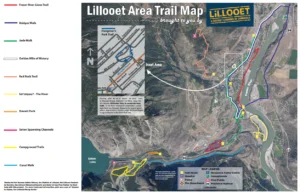
Canal Walk

  •   Parking: N50° 40’ 14.1’’ W121° 58’ 40.6’’
    Park on immediate south side of Canal Bridge on Highway 99.
  •   Distance: 3.2 kms (2 mi.) one-way
  •   Time: 40 minutes
  •   Difficulty: Easy

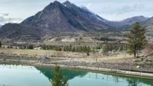
On this level roadway along the south side of the BC Hydro canal which connects Seton Lake with the powerhouse on the Fraser, you walk in the shadow of the majestic towering cliffs at the base Mt. Brew. Watch for waterfowl on the canal.

Continue ReadingCanal Walk

Sát’atqwa7 – The River

  •   Parking: N50° 40’ 51.2’’ W121° 55’ 49.7’’
    Park in parking area just off Powerhouse Road.
  •   Distance: 190 m to 2 km
  •   Time: 30 min. to 1 hour.
  •   Difficulty: Easy (rocky shoreline)

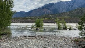
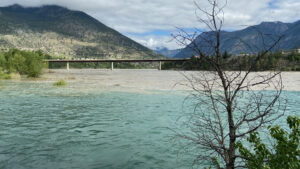
A chance to get up close to the mighty Fraser River. Enjoy a walk through an active ecological restoration site that showcases our beautiful grasslands and Black Cottonwood ecosystem at the confluence of the Seton and Fraser Rivers.

Continue ReadingSát’atqwa7 – The River

Golden Miles of History

  •   Parking: N50° 40’ 97.9’’ W121° 55’ 89.1’
    Park at Bridge of the 23 Camels.
  •   Distance: 4.5 km (2.8 miles)
  •   Time: 1 to 1.5 hours one-way
  •   Difficulty: Easy to moderate walk

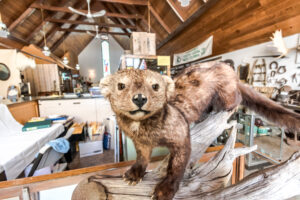
This walk highlights the many sights the Lilllooet Historical Society recommends you enjoy in a town whose post-European contact history dates back to the Cariboo Gold Rush. Pick up a “Golden Mile” brochure at the Lillooet Museum and Visitor Info Centre.

Continue ReadingGolden Miles of History

Fraser River Lions Trail

  •   Parking: 50°40’54.53”N 121°55’49.37”W
    Park in Cayoosh Campground close to the Bridge of the 23 Camels.
  •   Distance: 2.4 km (1.5 miles)
  •   Time: 45 min. one-way
  •   Difficulty: Easy to moderate

Built by the Lillooet Lions Club in the 1990s, the Lions Trail is a staple for local hikers, traversing the bank of the Fraser River through diverse habitat affording breathtaking views of the mighty river

Continue ReadingFraser River Lions Trail

Bridge of the 23 Camels

Following the discovery of gold in the Cariboo in 1858 and the completion of the first wagon road to Lillooet, horses, mules and oxen were used to haul heavy loads to the gold fields. An entrepreneur determined that camels would be ideal pack animals, so 23 two humped Bactrian camels were imported from Asia to BC. But this solution became an issue when the high-strung beasts ate miners clothing, kicked at anyone who came close, frightened other animals with their pungent odor, and cut their soft feet on the rocky mountainous roads. The camels were abandoned and left to roam in the wild. Some were killed for food, some died in winter storms, while others were kept as curiosities. The lone surviving Bactrian camel, “The Lady” as she was called, died around 1896 on a farm in Grande Prairie, BC (now known as Westwold).

When the bridge opened in 1981, the name was selected through a contest. Local resident, Renee Chipman submitted the winning name: “Bridge of the 23 Camels” in honour of the camels.

Continue ReadingBridge of the 23 Camels

Chinese Rock Piles

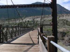
On both sides of the Fraser River at Lillooet one can find “Chinese Rocks” – a reminder of the search for gold by Chinese people before the turn of the century. Washing the sand and gravel for the elusive yellow metal, the Chinese neatly piled the washed rocks, in some places more than 12 feet high, in long rows. For examples, look close to the Hangmen’s Tree, downstream from the Old Suspension Bridge, and on the east side of the Fraser.

Continue ReadingChinese Rock Piles

Pacific Great Eastern Railway / BC Rail Station

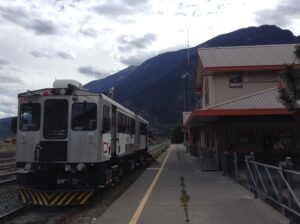
The old Pacific Great Eastern Railway reached Lillooet in 1914 and continued on into the Interior of BC. Its name was changed to the British Columbia Railway in 1972. The station seen today was built in 1986, replacing the old station that had been constructed in the 1920’s. The original route of the railway was also changed at one point: Originally, the track crossed the Fraser River at Cayoosh Creek, then rerouted through Lillooet to a crossing north of town by the Old Bridge. The old railway bridge was torn down in 1932.

Continue ReadingPacific Great Eastern Railway / BC Rail Station